- Services
- Project Management
- Engineering Survey
- Way Leave Survey
- Hard & Soft Landscaping Works
- Cadastrial Survey
- Boundary Alignment
- Mutation Survey
- Power Lines Construction
- Cartographic Works
- B.O.Q preparations
- Electrical works
- Property Management and Real Estate Agency
- Renovation and Remodeling Services
- Design Work
- General Construction Contractors
Contact Our Office
Please feel free to contact us. We will get back to you with 1-2 business days. Or just call us now.
CALL US: +254 722 253 299
CALL US: +254 711 772 727
MAIL US: enquiries@geo-smart.co.ke
MAIL US: geosmart2016@gmail.com
Boundary Alignment Surveyors Works
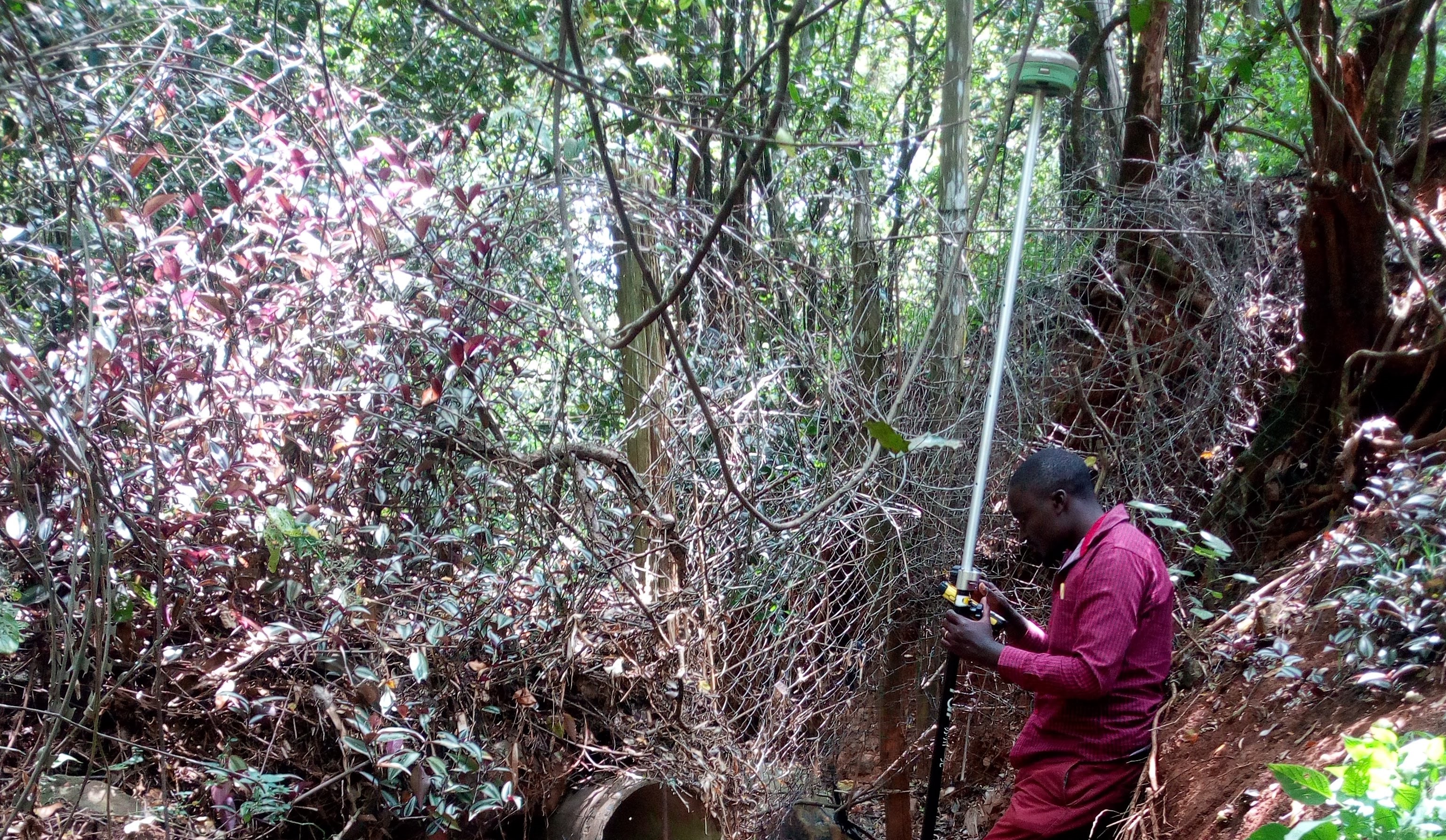
Land can be subdivided into various portions or amalgamated into a single portion. The following are steps for land survey: The first step taken by the landowner who wishes to sub-divide land will be to Conduct an Official Title Deed Search at the local land registry. To conduct the search, which normally takes three days, one must produce a copy of his/her national identity card, a copy of KRA PIN card and the copy of title deed number or its number. The search is important because it enables you to ascertain ownership of the land, and whether there are any encumbrances on the land, for instance, it might have been used to secure a loan. After the official search, the landowner, with the help of the surveyor, is required to obtain a Registry Index Map (RIM) from the Survey of Kenya. The RIM is a map that covers a large geographic area in which the land to be subdivided lies. After getting the map, the surveyor visits the land where he/she might Take some Ground Measurements to ascertain that the measurements indicated on the maps are the exact measurements on the ground. The reconnaissance also enables the surveyor to plan his/her work in order to avoid setting boundaries that might conflict with buildings and other permanent structures. The surveyor then prepares a Subdivision Scheme, which must be signed by a Registered Physical Planner who, once satisfied with the surveyors’ plans, gives a Physical Planning Act form commonly known as PPA 1 Form. The subdivision’s blueprints are then taken to the County Lands Office for approval, after which a PPA2 Form is issued. After submitting the Subdivision Blueprints, a current Title Search (valid for three months after date of issue), the PPA1 and the PPA2 forms, the land owner can Book a Meeting with the Local Land Control Board. The land control board is a meeting of local elders who sit at the district level (now sub-counties) and approves all land transfers in their area. A meeting with the land control board must be booked at least two weeks in advance, and the board sits only once a month. During the meeting with the land control board, a land owner is typically asked what their intentions of subdividing the land are. He/she is also required to present himself/herself in front to the board with their spouse. Land and Cadastral SurveyAfter getting the Land Control Board’s Consent, the surveyor places Beacons to mark the boundaries. For general boundaries, which is usually the case in many rural areas, an error margin of one metre is allowed when the placement of beacons marking the land’s boundaries. In urban centres, however, cadastral (fixed) land boundaries, whose beacon positioning is measured in coordinates, are preferred. Once the boundaries are marked, both the land owner and the surveyor are required to sign three copies of the Mutation Form, which are further signed by a more senior surveyor, known as the Licensed Surveyor. The mutation forms, together with the search document, the consent form from the Land Control Board, the PPA1 and the PPA2 forms are then deposited with the district survey office, where a cartographer allocates new plot numbers to the subdivided plots. The same documents are then taken to the respective land county registries to allow the land registrar to register the titles. The copies of mutation forms certified by the land registrar are then deposited with the Survey of Kenya to allow for the amendment of the maps.
Whether constructing new buildings, erecting new fencing, selling a property, setting out covenant areas, or disputing a boundary, only a Licensed Cadastral Surveyor is legally empowered to define the boundaries
Various options are possible including locating existing boundary pegs, a complete boundary reinstatement (monumentation) survey, providing Certification of the siting of buildings within boundaries, marking of boundary alignments or providing boundary offset marks
All the options can be discussed and are dependent on the purpose and any legal issues involved.
Knowing the exact location of your boundaries will help avoid expensive encroachment disputes and possible disputes with your neighbor’s. It will also give buyers confidence in a purchase.
Geo-Smart Engineering can assist to resolve existing boundary problems, confirm the correctness of existing boundary marks, replace pegs, advice regarding boundary disputes and possible remedies, and prepare legal survey data to document the location of your boundaries.
Understanding the extent and location of rights associated with the land is important in utilizing the full potential use and ultimately the valuation of the property.
Easements provide important land use rights for property access, utility services or other rights for persons or authorities to enter other persons land. With modern land development easements are increasingly used to protect property rights.
Why Choose Us
We have acquired high standards of perfection in Boundary Alignment Survey. At Geo-Smart Engineering, we ensure that the best quality equipments and tools are used for and the work is completed within the stipulated period of time.

Boundary Alignment Survey Technology

Customized Boundary Alignment Survey Work Solutions

All Expert Engineers

Boundary Alignment Survey Work Function
Service Enquiry
2021 © All Rights Reserved By Geo-Smart Engineering & Real State Contractors Limited Designed by Belfor Tech Consultant.